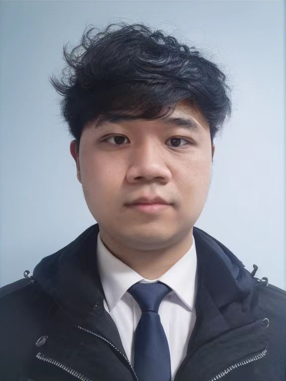
夏宇 Yu Xia 中国科学院深圳先进技术研究院 副研究员 硕士生导师
个人简介:
本人夏宇,2018年、2024年分别于武汉大学获得遥感科学与技术学士学位、摄影测量与遥感专业博士学位,2026年鹏城实验室博士后出站,同年加入中国科学院深圳先进技术研究院,长期深耕计算机、地理信息与高性能计算交叉领域,主要研究时空数据智能分析、图像超分重建、遥感数据智能计算与大规模地理制图,技术落地于生态遥感监测、城市时空感知等场景。积极推动科研开源,牵头构建6套全球尺度遥感开源数据集,总下载量万次以上。累计发表学术论文20余篇,兼任多本权威期刊审稿人,主持国家自然科学基金青年项目、中国博士后科学基金面上项目,核心参与多项国家级、省部级课题,申请发明专利及软件著作权10余项,斩获3项IEEE GRSS国际遥感赛事冠亚军,多次协办全国性学术会议与竞赛。
研究方向: 计算机视觉、时空数据分析、遥感数据智能计算、城市大数据融合解译
相关链接: 谷歌学术主页 ResearchGate主页
联系方式: yu.xia@siat.ac.cn | 广东深圳
欢迎计算机、遥感、电子信息等相关专业同学报考研究生!可随时邮箱联系咨询相关情况。
教育与工作经历
 |
 |
 |
|
|||
| 2026.08 至今 中国科学院深圳先进技术研究院 数字所 副研究员 |
2024.07 - 2026.08 鹏城实验室 网络智能部 博士后 |
2018.09 - 2024.06 武汉大学 测绘遥感信息工程全国重点实验室 摄影测量与遥感 硕士、博士 |
2014.09 - 2018.06 武汉大学 遥感信息工程学院 遥感科学与技术 学士 |
学术论文(时间先后排序):
[01] Xia Y., Lin T., Liu X., ..., Wang J., and Gong P. (2026). Make More Pixels Usable: A Data-Driven Framework for Customizable Cloud and Shadow Processing in Satellite Imagery [J]. ISPRS Journal of Photogrammetry and Remote Sensing, vol. 237, pp. 355-373. (第一作者, SCI, 中科院一区TOP, IF=12.2) [02] Xia Y., Lin T., Liu X., Gong P., and Wang J. (2026). From 30 m to 10 m: Continuous Monitoring of Impervious Surface Area from 2000 to 2024 via Prior-Guided Super-Resolution [J]. Remote Sensing of Environment, Under Review. (第一作者, SCI, 中科院一区TOP, IF=11.4) [03] Qin, P., Huang, H., Wang, J., Cui, Y., Chen, P., Chen, S., Xia, Y., ... & Liu, X. (2026). Unveiling spatiotemporal forest cover patterns breaking the cloud barrier: Annual 30 m mapping in cloud-prone southern China from 2000 to 2020. ISPRS Journal of Photogrammetry and Remote Sensing, 232, 848-864. (第七作者, SCI, 中科院一区TOP, IF=12.2) [04] Chen, S., Wang, J., Yuan, S., Li, J., Xia, Y., Liao, Y., ... & Gong, P. (2026). Democratizing planetary-scale analysis: An ultra-lightweight Earth embedding database for accurate and flexible global land monitoring. Earth System Science Data, accept. (第五作者, SCI, 中科院一区TOP, IF=11.6) [05] Liu, X., He, W., Xia, Y., Wang, J., & Zhang, H. (2026). From national to global: Mapping global center-pivot irrigated cropland with knowledge-guided data augmentation [J]. Remote Sensing of Environment, Major revision. (第三作者, SCI, 中科院一区TOP, IF=11.4) [06] Yuan, S., Lin, T., Chen, S., Xia, Y., Qin, P., Liu, X., ... & Gong, P. (2026). Wetland mapping from sparse annotations with satellite image time series and temporal-aware segment anything model. [J]. ISPRS Journal of Photogrammetry and Remote Sensing, accept. (第四作者, SCI, 中科院一区TOP, IF=12.2) [07] Lin, T., Xia, Y., and Wang, J. (2026, July). Pixel Transformer Based Complex-Valued Fusion Network for Joint Hyperspectral-Lidar Classification. In IGARSS 2026-2026 IEEE International Geoscience and Remote Sensing Symposium (pp. 1-4). IEEE. Accept. (第二作者, EI, 国际会议Poster) [08] Xia Y., He W., Zhang H., and Zhang, L. (2025). Began+: Leveraging Bi-Temporal SAR-Optical Data Fusion to Reconstruct Clear-Sky Satellite Imagery Under Large Cloud Cover [J]. Remote Sensing of Environment, vol 334, number.115171. (第一作者, SCI, 中科院一区TOP, IF=11.4) [09] Xu, X., He, W., Xia, Y., Zhang, H., Wu, Y., Jiang, Z., & Hu, T. (2025). TANet: Thin Cloud Aware Network for Cloud Detection in Optical Remote Sensing Image. IEEE Transactions on Geoscience and Remote Sensing, vol. 63, pp. 1-16. (第三作者, SCI, 中科院一区TOP, IF=8.6) [10] Li, J., Huang, H., Xia, Y., Xu, X., Wu, Y., Guo, Q., ... & Hong, D. (2025). Multimodal Semantic Segmentation in Yangtze River Economic Belt: Outcome of the 2024 IEEE WHISPERS MMSeg-YREB Challenge. IEEE Journal of Selected Topics in Applied Earth Observations and Remote Sensing, vol. 18, pp. 16534-16548. (第三作者, SCI, 中科院二区, IF=5.3) [11] Xia, Y., He, W., Huang, Q., Chen, H., Huang, H., and Zhang, H. (2024). SOSSF: Landsat-8 image synthesis on the blending of Sentinel-1 and MODIS data. IEEE Transactions on Geoscience and Remote Sensing, vol. 62, pp. 1-19. (第一作者, SCI, 中科院一区TOP, IF=8.6) [12] Xia, Y., He, W., Huang, Q., Yin, G., Liu, W., and Zhang, H. (2024). CRformer: Multi-Modal Data Fusion to Reconstruct Cloud-Free Optical Imagery. International Journal of Applied Earth Observation and Geoinformation, vol. 128, number. 103793. (第一作者, SCI, 中科院一区TOP, IF=8.6) [13] Huang, H., He, W., Zhang, H., Xia, Y., and Zhang, L. (2024). STFDiff: Remote sensing image spatiotemporal fusion with diffusion models. Information Fusion, 102505. (第四作者, SCI, 中科院一区TOP, IF=15.5) [14] Yin, G., He, W., Liu X., Xia, Y., Zhang, H. (2024). Wetting or greening? Probing the global trends in Vegetation Condition Index (VCI), International Journal of Applied Earth Observation and Geoinformation, vol. 129, number. 103822. (第四作者, SCI, 中科院一区TOP, IF=8.6) [15] Liu, W., Li, S., Tao, J., Liu, X., Yin, G., Xia, Y., ... and Zhang, H. (2024). CARM30: China annual rapeseed maps at 30 m spatial resolution from 2000 to 2022 using multi-source data. Scientific Data, 11(1), 356. (第六作者, SCI, 中科院二区, IF=6.9) [16] Li, J., Huang, H., & Xia, Y. (2024, December). Fusion of Multiple Models with Multi-Modal Datasets: Land Cover Mapping in the Yangtze River Economic Belt. In 2024 14th Workshop on Hyperspectral Imaging and Signal Processing: Evolution in Remote Sensing (WHISPERS) (pp. 1-5). IEEE. (第三作者, EI, 国际会议Oral) [17] Yin, G., He, W., Liu, W., Liu, X., Xia, Y., and Zhang, H. (2024). Drought Stress and its Characteristics in China from 2001 to 2020 Considering Vegetation Response and Drought Creep Effect. Journal of Hydrology: Regional Studies, vol. 53, number. 101763. (第五作者, SCI, 中科院二区, IF=5) [18] Guo, Y., He, W., Xia, Y., and Zhang, H. (2023). Blind single-image-based thin cloud removal using a cloud perception integrated fast Fourier convolutional network. ISPRS Journal of Photogrammetry and Remote Sensing, 206, 63-86. (第三作者, SCI, 中科院一区TOP, IF=12.2) [19] Xu, X., He, W., Xia, Y., and Zhang, H. (2023, July). A New Cloud Feature Difference Loss For Enhancing The Detection Of Clouds In Remote Sensing Images. In IGARSS 2023-2023 IEEE International Geoscience and Remote Sensing Symposium (pp. 5190-5193). IEEE. (第三作者, EI, 国际会议Poster) [20] Fan, Z., Zhan, Q., Liu, H., Wu, Y., and Xia, Y. (2022). Investigating the interactive and heterogeneous effects of green and blue space on urban PM2. 5 concentration, a case study of Wuhan. Journal of Cleaner Production, 378,134389. (第五作者, SCI, 中科院一区TOP, IF=10) [21] Xia, Y., Huang, Q., and Zhang, H. (2021, July). A multi-model fusion of convolution neural network and random forest for detecting settlements without electricity. In 2021 IEEE International Geoscience and Remote Sensing Symposium IGARSS (pp. 1843-1846). IEEE. (第一作者, EI, 国际会议Oral) [22] Ma, Y., Li, Y., Feng, K., Xia, Y., Huang, Q., Zhang, H., ... and Yokoya, N. (2021). The outcome of the 2021 IEEE GRSS data fusion contest-Track DSE: Detection of settlements without electricity. IEEE Journal of Selected Topics in Applied Earth Observations and Remote Sensing, 14, 12375-12385. (第四作者, SCI, 中科院二区, IF=5.3) [23] Xia, Y., Liao, Y., Zhang, H., and Yang, G. (2020, September). Land cover mapping based on multi-branch fusion of object-based and pixel-based segmentation with filtered labels. In IGARSS 2020-2020 IEEE International Geoscience and Remote Sensing Symposium (pp. 7050-7053). IEEE. (第一作者, EI, 国际会议Oral) [24] Xia, Y., Zhang, H., Zhang, L., and Fan, Z. (2019, July). Cloud removal of optical remote sensing imagery with multitemporal SAR-optical data using X-Mtgan. In IGARSS 2019-2019 IEEE International Geoscience and Remote Sensing Symposium (pp. 3396-3399). IEEE. (第一作者, EI, 国际会议Poster) [25] 樊智宇,詹庆明,刘慧民,杨晨,&夏宇.(2019).武汉市夏季城市热岛与不透水面增温强度时空分布,地球信息科学学报,21(2), 226-235. (第五作者, EI期刊)科研项目:
[1] 国家自然科学基金青年基金项目,30万元,项目负责人(在研)
[2] 中国博士后科学基金面上资助,8万元,项目负责人(结题)
[3] 国家实验室重大攻关项目(PCL2024A04),项目骨干
[4] 国家重点研发国际合作重点专项,项目骨干
[5] 武汉市基础前沿项目,项目骨干
[6] 国家自然科学基金面上项目,参与人员
知识产权:
[1] 夏宇,王杰,柳向宇等,不透水面区域的标注方法、装置、电子设备及存储介质 [P]. 2025-07-30. (第一完成人, 发明专利)
[2] 夏宇,王杰,徐晓晴等,多源图像样本比对筛选系统v1.0. 2026-01-11. (第一完成人, 软件著作权)
[3] 张洪艳,黄琪,夏宇,张良培,基于深度低秩网络的多时相光学遥感影像云检测方法 [P]. 2022-09-30. (第三完成人, 发明专利)
[4] 李佳阳,王杰,陈爽,夏宇等,一种基于谐波残差分解与可解释时序聚合的月度高分辨率地表温度重建方法 [P]. 2026-05-14. (第四完成人, 发明专利)
[5] 徐晓晴,魏俊博,王凯,王杰,夏宇等,一种基于特征空间质心重编码的遥感嵌入数据多尺度重采样方法 [P]. 2026-05-19. (第五完成人, 发明专利)
[6] 徐晓晴,魏俊博,王凯,王杰,夏宇等,一种基于位平面重组重编码的云原生遥感影像储存方法 [P]. 2026-05-20. (第五完成人, 发明专利)
[7] 柳向宇,王杰,夏宇等,长时序卫星制图结果分析展示系统v1.0. 2026-02-12. (第三完成人, 软件著作权)
[8] 柳向宇,王杰,夏宇等,时空数据验证样本解译软件v1.0. 2026-02-13. (第三完成人, 软件著作权)
[9] 秦鹏,王杰,徐晓晴,夏宇等,时间序列植被指数重建软件, 2026-03-02. (第四完成人, 软件著作权)
[10] 秦鹏,王杰,徐晓晴,侯文敬,夏宇等,人工林智能识别与分析系统, 2026-03-06. (第五完成人, 软件著作权)
科研与竞赛活动:
[1] 2024 IEEE Multimodal Semantic Segmentation Challenge, First Place. (国际竞赛冠军, 指导老师)
[2] 2021 IEEE GRSS Data Fusion Contest, Second Place. (国际竞赛亚军, 第一排序)
[3] 2020 IEEE GRSS Data Fusion Contest, Second Place. (国际竞赛亚军, 第一排序)
[4] 第二届人工智能与遥感科学交叉论坛(AIRS) AIRS-2025开发大赛. (全国科研赛事举办, 工作组组长)
[5] 第三届人工智能与遥感科学交叉论坛(AIRS) AIRS-2026“国测海遥杯"开发大赛. (全国科研赛事举办, 工作组组长)
数据发布:
[1] Xia, Y., & Zhang, H.Y. MTSOD-dataset. Kaggle, 2022. [link] (第一完成人, 深度学习数据集)
[2] Xia, Y. SMILE_Dataset. Kaggle, 2023. [link] (第一完成人, 深度学习数据集, 全球分布)
[3] Xia, Y. E-SMILE (Extended SMILE with Extral Data). Kaggle, 2023. [link] (第一完成人, 深度学习数据集, 全球分布)
[4] Xia, Y. SMILE-CR. Kaggle, 2024. [link] (第一完成人, 深度学习数据集, 全球分布)
[5] Xia, Y. BISO-CR. Kaggle, 2024. [link] (第一完成人, 深度学习数据集, 全球分布)
[6] Xia, Y. CloudL8-LC. iEarth DataHub, 2025. [link] (第一完成人, 深度学习数据集, 全球分布)